Buscador de Mapas | General Plan of the Routes of the Armies before & after the Battle of Talavera 1809
Añadir a colecciónVolver al listado
FICHA MAPA
ISBD
MARC 21
ISO 19115
Título:
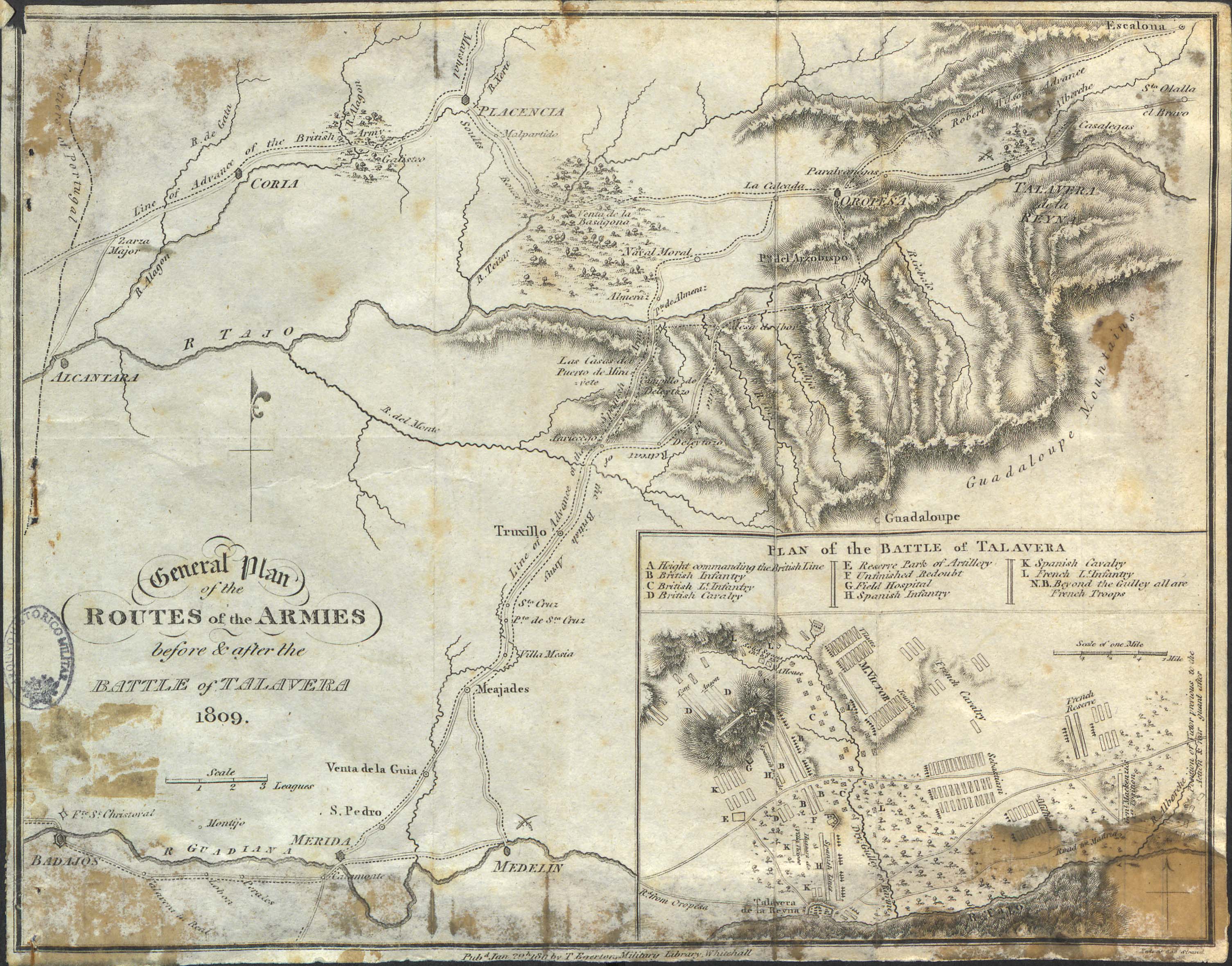
General Plan of the Routes of the Armies before & after the Battle of Talavera 1809
Edición:
[London] : pubd. Jan. 29st. 180 [sic] by T. Egerton, Military Library, Whitehall
NOTAS
Representación de las rutas de defensa y ataque de las tropas españolas, francesas e inglesas participantes en la batalla de Talavera, antes y después de la misma – Red hidrográfica y de caminos. – Arbolado. – Relieve por normales y sombreado. – Orientado al N con flecha. – Inserta mapa : Plan of the battle of Talavera. – Escala de 1 milla. – Orientado al norte con flecha. – Clave alfabética con la posición de las distintas tropas. – En: Eliot, William Granville. “A treatise on the defence of Portugal with a military map of the country…”, 1811. – Datos de publicación tomados de la obra en la que se incluyó el mapa
ISBD:
Neele, Samuel John (1758– 1824)
General Plan of the Routes of the Armies before & after the Battle of Talavera 1809 / Neele Strand; [Eliot, William Granville]. — Escala de 3 leguas. — [London] : pubd. Jan. 29st. 180 [sic] by T. Egerton, Military Library, Whitehall, 1811.
1 mapa : grab. ; 20 x 26 cm
Representación de las rutas de defensa y ataque de las tropas españolas, francesas e inglesas participantes en la batalla de Talavera, antes y después de la misma – Red hidrográfica y de caminos. – Arbolado. – Relieve por normales y sombreado. – Orientado al N con flecha. – Datos de publicación tomados de la obra en la que se incluyó el mapa. – Inserta mapa : Plan of the battle of Talavera. – Escala de 1 milla. – Orientado al norte con flecha. – Clave alfabética con la posición de las distintas tropas. – En: Granville Eliot, William. 'A treatise on the defence of Portugal with a military map of the country…'. London: 1811
I. Neele, Samuel John (1758– 1824). II. Granville Eliot, William
Marc 21:
000 ####cmm##22######i#4500
005 20160427130306.0
007 aj*canzn
008 160427s1811####enk#######a#####1###eng#d
034 0# $aa
041 0# $aeng
130 0# $aTalavera.$kBatallas.$f1811
245 10 $aGeneral Plan of the Routes of the Armies before & after the Battle of Talavera 1809 / $cNeele Strand; [Granville Eliot, William].
255 ## $aEscala de 3 leguas
260 ## $a[London] :$bpubd. Jan. 29st. 180 [sic] by T. Egerton, Military Library, Whitehall, $c1811.
300 ## $a1 mapa :$bgrab. ; $c20 x 26 cm
501 ## $aInserta mapa : Plan of the battle of Talavera. – Escala de 1 milla. – Orientado al norte con flecha. – Clave alfabética con la posición de las distintas tropas.
581 8# $aEn: Granville Eliot, William. 'A treatise on the defence of Portugal with a military map of the country…'. London : 1811.
592 ## $aRepresentación de las rutas de defensa y ataque de las tropas españolas, francesas e inglesas participantes en la batalla de Talavera, antes y después de la misma – Red hidrográfica y de caminos. – Arbolado. – Relieve por normales y sombreado. – Orientado al N con flecha. – Datos de publicación tomados de la obra en la que se incluyó el mapa
650 #4 $aBatallas
651 #4 $aTalavera$vBatallas
700 1# $aNeele, Samuel John (1758– 1824)
700 1# $aGranville Eliot, William.
852 ## $aArquivo Histórico Militar. Exército Português$jPT/AHM/DIV/3/47/AV2/5724
856 4# $uhttp://sitex.gobex.es/SITEX/pages/cartoteca?page=ficha&fid=491
ISO 19115:
Puede descargarse las descripciones en formato html y en xml.
Si se descarga la versión en html necesitará también el fichero .css
Fichero XML:DescargarVer
Aumentar Tamaño de Imagen
Descargar en alta resolución


