Buscador de Mapas | Sketch of the Disposition of the Allies under the command of Lieut. Genl. Hill to surprize the Enemy
Añadir a colecciónVolver al listado

Marc 21:
000 ######eme#########i#####
005 20100213
007 aj*canzn
008 100119q1813####gbrb######a#####0#eng##
034 1# $aa$b162293
041 0# $aeng
130 0# $aArroyomolinos de Montánchez(Cáceres).$kBatallas.$f1813
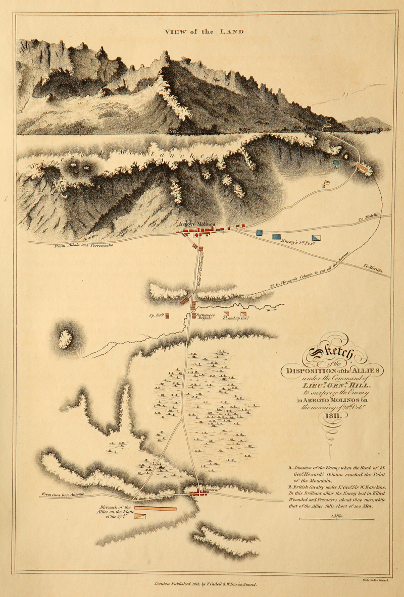
245 00 $aSketch of the Disposition of the Allies under the command of Lieut. Genl. Hill to surprize the Enemy in Arroyo Molinos on the morning of 28th. Oct. , 1811
255 ## $aEscala [ca. 1:42.000]. 1 milla [= 3,9 cm]
260 ## $aLondon : T. Cadell y W. Davies Strand, 1813.
300 ## $a1 mapa:$bgrab. , col. ; $c38 x 26 cm
520 ## $aEn la parte superior aparece un perfil del terreno donde se desarrolló la batalla de Arroyomolinos de Montánchez en 1811
592 ## $aRelieve por sombreado. – Red hidrográfica y de caminos. – Arbolado. – Clave alfabética de la explicación de la situación de los enemigos en la batalla y la caballería inglesa
599 ## $aDecoración en la parte superior del título con elementos tipográficos.
700 1# $aCadell, Thomas$d(1742 – 1802)$e, ed.
700 1# $aDavies, W.$e, ed.
852 ## $aJunta de Extremadura. Centro de Información Cartográfica y Territorial de Extremadura$jES.06800.CHDE.CH012
856 4# $uhttp://sitex.gobex.es/SITEX/pages/cartoteca?page=ficha&fid=35

Ayúdanos a mejorar la información prestada a través de tus comentarios:
Indicar un error en la ficha del mapa Indicar otra institución en la cual se encuentre conservado este mapa Indicar otra publicación en la cual se mencione este mapa